
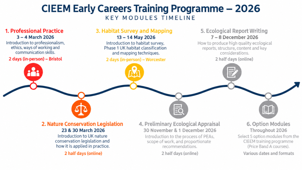
Dates: 13–14 May 2026
Location: Worcester Woods Country Park, Worcester
Organisation: Chartered Institute of Ecology and Environmental Management (CIEEM)
Course: Habitat Survey and Mapping
Tutor: Paul Losse MCIEEM, Salix Ecology
Programme: Early Careers Training Programme – Core Module 3
Duration: Two days of practical and classroom-based training
Introduction
On 13 and 14 May 2026, I attended the third core module of CIEEM’s Early Careers Training Programme at Worcester Woods Country Park. The course focused on habitat identification, classification and mapping, combining classroom learning with practical field exercises.
Having previously studied professional ecological practice and nature conservation legislation, this module provided an opportunity to develop some of the technical skills required to undertake ecological assessments.
The course introduced the principles of habitat surveying, including the traditional Joint Nature Conservation Committee (JNCC) Phase 1 Habitat Survey methodology and the more contemporary UK Habitat Classification system (UKHab).
I found the introduction to UKHab particularly valuable because it is now a preferred classification approach for many professional habitat surveys in the UK, especially those supporting Biodiversity Net Gain assessments in England.
The two days also helped me understand that habitat surveying involves much more than recognising different types of vegetation. It requires botanical knowledge, spatial awareness, careful observation, accurate mapping and an understanding of how ecological information will be used.
A central question emerged:
How can ecologists consistently classify complex, naturally variable habitats into clearly defined categories?
The course demonstrated the importance of standardised classification systems while recognising that ecological boundaries are not always as distinct as those shown on a map.
1. Why Do We Undertake Habitat Surveys?
Habitat surveys provide a systematic method of identifying, describing and mapping habitats within a defined geographical area.
They form an important part of ecological assessment, conservation planning, biodiversity monitoring and habitat management.
The purpose of a survey influences the level of detail required.
For example, a broad habitat assessment may establish the principal habitat types present across a landscape, whereas a detailed survey undertaken for a development proposal may require precise habitat boundaries, vegetation descriptions and information about potential ecological constraints.
Habitat surveys can support:
- Preliminary Ecological Appraisals (PEAs).
- Ecological Impact Assessments (EcIAs).
- Biodiversity Net Gain assessments.
- Conservation management plans.
- Habitat restoration and enhancement projects.
- Ecological monitoring and land management decisions.
One of the most important lessons was understanding that the purpose of a habitat survey should be clearly established before fieldwork begins.
This prompted an interesting question:
How does the intended use of ecological data determine the appropriate survey methodology and level of detail?
A classification that is sufficient for preliminary habitat mapping may not provide the detail required for a statutory biodiversity metric calculation or a specialist botanical assessment.
2. Phase 1 Habitat Survey – Understanding the Traditional Approach
The JNCC Phase 1 Habitat Survey methodology has been widely used in Britain for several decades.
It provides a standardised system for identifying broad habitat types and representing their distribution using maps, colours and alphanumeric codes.
The method was designed to provide a relatively rapid assessment of semi-natural vegetation and other land cover.
For example, Phase 1 classification distinguishes broad habitat categories such as woodland and scrub, grassland, heathland, open water and wetland habitats.
Strengths of Phase 1
The traditional methodology provides:
- A relatively straightforward approach to broad habitat classification.
- Standardised mapping conventions.
- A consistent system for describing habitats.
- A useful foundation for site comparisons.
- An established framework for preliminary ecological assessments.
However, the course also explored limitations associated with the system.
Phase 1 categories do not always capture the ecological complexity of habitats, particularly where vegetation forms a mosaic or where more detailed classification is required.
The traditional method is also less directly aligned with contemporary Biodiversity Net Gain assessments.
An important distinction made in the course material is that a Phase 1 habitat survey, by itself, is not a protected species survey.
Although habitat characteristics may indicate the potential presence of protected species, appropriate species-specific assessments are required where relevant.
3. UK Habitat Classification – The Preferred Modern Approach
One of the most important learning outcomes was developing an understanding of the UK Habitat Classification system (UKHab).
UKHab was introduced in 2018 to provide a modern, consistent and comprehensive framework for identifying and mapping habitats.
It addresses some of the limitations associated with earlier classification systems by providing a more detailed hierarchy of habitat categories.
UKHab is increasingly the preferred system for contemporary habitat surveys in the UK and is the principal habitat classification underpinning England’s statutory Biodiversity Net Gain metric.
This makes it particularly relevant to ecological consultancy, development planning, habitat assessment and biodiversity monitoring.
How Does UKHab Work?
UKHab uses a hierarchical classification structure, allowing habitats to be identified at different levels of detail.
Broad habitat categories are progressively subdivided into more specific types.
For example:
Grassland → Neutral grassland → Other neutral grassland → Arrhenatherum communities
The course material provided the UKHab primary habitat code g3c5 as an example of this classification.
A particularly useful feature of UKHab is the ability to assign:
- Primary habitat codes, identifying the principal habitat category.
- Secondary codes, recording additional ecological characteristics or features associated with the habitat.
This allows the classification to represent more information about an area than a broad habitat label alone.
The system can be applied to mapped polygons, linear features and point features.
Why Is UKHab Important for Biodiversity Net Gain?
Biodiversity Net Gain is an approach to development that aims to leave biodiversity in a measurably better state than before development, subject to applicable statutory requirements.
In England, the statutory biodiversity metric uses habitat information to calculate biodiversity units.
The calculation considers factors including habitat type, area, condition and strategic significance.
UKHab provides the habitat classification framework used for most terrestrial habitat categories in this metric.
Accurate classification is therefore important because identifying the wrong habitat type could lead to an incorrect biodiversity valuation.
This highlighted a particularly important consideration:
How much can an incorrect habitat classification influence the outcome of a Biodiversity Net Gain assessment?
If a species-rich grassland is incorrectly classified as modified grassland, for example, this could materially affect its assigned biodiversity value and the ecological recommendations derived from the assessment.
This reinforced the importance of botanical competence and applying classification guidance accurately.
Is UKHab Replacing Phase 1?
UKHab offers a more detailed and contemporary framework, particularly for assessments requiring alignment with biodiversity metrics.
However, Phase 1 remains a recognised survey methodology and can still be appropriate for certain purposes.
The decision to use UKHab or Phase 1 should therefore be based on the objectives of the survey, reporting requirements and applicable guidance.
For my future professional development, gaining confidence in UKHab classification is a priority because of its importance to contemporary ecological consultancy.
4. Planning an Effective Habitat Survey
A significant part of the course focused on the preparation required before undertaking fieldwork.
The handbook identified several important planning considerations.
Defining the Survey Scope
The surveyor must establish what information is required, the geographical extent of the survey and the level of classification detail needed.
Desk Study
Existing ecological information should be reviewed before visiting the site.
Potential sources include aerial photography, historical habitat maps, biological records, designated site information and existing ecological reports.
This can help identify habitats of potential conservation importance and determine whether specialist botanical expertise may be necessary.
Timing
The timing of habitat surveys can significantly influence identification accuracy.
The course emphasised that grasslands can be particularly difficult to classify outside the main growing season.
Many indicator plants are less conspicuous during winter, increasing the risk of misclassification.
The time required for fieldwork also depends on topography, vegetation complexity, access and the level of detail required.
A relatively uniform agricultural landscape may be surveyed more quickly than a complex mosaic of wetlands, woodland and grassland.
Access and Health and Safety
Survey planning must include appropriate landowner permission, safe working arrangements and suitable equipment.
A survey should not begin on the assumption that access will be permitted.
The course reinforced how important planning is to both the efficiency and reliability of ecological fieldwork.
5. Practical Habitat Surveying at Worcester Woods
One of the most valuable aspects of the course was undertaking practical habitat identification and mapping exercises at Worcester Woods Country Park.
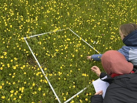
The park provided a useful setting because it contains a mixture of woodland, meadow and managed amenity habitats.
According to the site’s visitor information, the country park covers approximately 38 hectares and includes two Local Nature Reserves: Nunnery Wood and Hornhill Meadows.
These habitats demonstrate how land-use history and management can influence the development of different vegetation communities.
Nunnery Wood
Nunnery Wood is described as ancient semi-natural woodland, with mature oak trees and areas of hazel coppice.
Ancient woodland is particularly important because of the ecological continuity associated with long-established woodland conditions.
The presence of mature trees, coppice habitats and woodland ground flora creates a structurally varied environment.
For habitat surveying, woodland assessment requires consideration of factors such as:
- Dominant tree and shrub species.
- Woodland structure and canopy composition.
- Ground flora and understorey.
- Evidence of coppicing or other management.
- Habitat continuity and ecological features.
Hornhill Meadows
Hornhill Meadows provides an example of species-rich grassland managed through grazing.
The visitor guide identifies flowering plants including yellow rattle, black knapweed, lady’s bedstraw and red clover.
These species can provide useful information about grassland composition and management history.
However, classification should not rely on a small number of individual species.
Accurate habitat identification requires evaluating the wider plant community, vegetation structure and ecological conditions.
The contrast between woodland, meadow and amenity habitats made Worcester Woods a suitable location for introducing practical habitat survey methods.
6. Botanical Identification and Habitat Classification
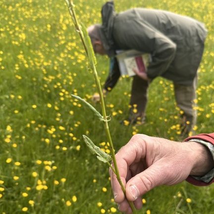
The course demonstrated that botanical identification is fundamental to habitat surveying.
Although the objective is not necessarily to produce a comprehensive botanical inventory, surveyors must be able to recognise characteristic species and vegetation communities.
For example, grassland classification may require distinguishing between modified grassland, neutral grassland, acid grassland and calcareous grassland.
These categories can differ in species composition, soil conditions, management history and ecological value.
One important lesson from the handbook was the risk of misidentifying unimproved grassland as a more modified habitat type.
This has implications for both conservation assessments and biodiversity calculations.
The course also reinforced the importance of recognising when identification is uncertain.
Accurate habitat classification requires appropriate botanical knowledge, but professional competence also involves recognising when more specialist assessment is necessary.
This raised another question:
How can an ecologist distinguish between habitats that appear visually similar but differ significantly in botanical composition and conservation value?
Developing this ability will require continued practice with grasses, sedges, rushes and flowering plants, alongside a stronger understanding of plant communities.
7. Habitat Mapping – Turning Field Observations into Spatial Data
Mapping was a major component of the course.
A habitat map provides a spatial representation of the extent and distribution of different habitat types.
The map should allow its reader to understand where habitats occur, how they relate to surrounding features and approximately how much area each occupies.
Aerial Photography
The handbook highlighted the importance of using recent aerial photographs as the basis for mapping.
Aerial imagery provides useful information about vegetation boundaries, landscape features and potential habitat variation.
However, aerial imagery alone cannot reliably determine all habitat classifications.
Field verification remains essential.
Habitat Polygons
Habitats are commonly represented using polygons that define the boundaries of individual habitat parcels.
The surveyor must decide where one habitat ends and another begins.
This can be challenging because vegetation communities frequently merge through transitional zones rather than forming distinct boundaries.
Minimum Mapping Units
The course introduced the concept of the Minimum Mapping Unit (MMU).
This determines the smallest habitat feature that will normally be mapped separately.
Examples discussed included mapping thresholds of 400 m² with 5 m linear features, or finer-scale mapping of 25 m² with 1 m linear features.
The appropriate threshold depends on the survey objectives and mapping requirements.
Choosing an appropriate MMU is important because a coarse approach may overlook small but ecologically significant habitat patches, while an excessively detailed approach can make mapping unnecessarily complex.
Geographic Information Systems
Habitat maps can be digitised and analysed using Geographic Information Systems (GIS).
Software such as QGIS or ArcGIS allows habitat boundaries to be represented spatially and associated with classification codes and other ecological information.
This enables habitat areas to be calculated, spatial relationships to be examined and maps to be incorporated into ecological reports.
I found this particularly relevant to my developing GIS skills and the potential to combine ecological fieldwork with spatial data analysis.
8. The Importance of Target Notes
Another useful component of the course was learning how target notes support habitat mapping.
Target notes are used to record important ecological features or information that may not be adequately represented by habitat polygons.
They typically include a geographical reference and a concise description.
Examples include:
- Small habitat features that cannot be mapped separately.
- Notable plant species.
- Evidence of protected or priority species.
- Invasive non-native plants.
- Habitat management activities.
- Features of conservation interest.
- Information that clarifies habitat boundaries or vegetation characteristics.
A particularly important point was that target notes should be proportionate to the purpose of the survey.
Recording excessive detail can make the process inefficient, while inadequate notes can result in important ecological information being lost.
This is especially relevant when producing professional ecological reports, where field observations must be clearly communicated to people who did not undertake the survey.
9. Common Pitfalls in Habitat Surveying
The course handbook identified several mistakes that can reduce the quality of habitat surveys.
These included:
Insufficient site coverage
Surveying only from roads or accessible viewpoints may overlook important habitats.
Poor survey timing
Undertaking surveys outside appropriate seasons can limit botanical identification and affect classification confidence.
Incorrect habitat identification
Misclassifying habitats may result in inaccurate ecological assessments.
Inappropriate mapping scale
Maps that are too generalised may fail to represent small but important habitat features.
Inadequate field notes
Poor records make it difficult to justify habitat classifications or prepare accurate reports.
Confusing survey objectives
Trying to complete several different ecological assessments simultaneously may reduce the quality of individual tasks.
The course reinforced that a habitat survey should be undertaken systematically, with sufficient attention to the purpose, scale and ecological complexity of the site.
10. How Habitat Surveys Support Ecological Consultancy
One of the most important outcomes of the course was understanding how habitat identification and mapping contribute to wider professional ecological assessments.
Habitat surveys are often an initial stage in assessing a site’s biodiversity.
They may help identify ecological constraints, inform the need for further protected species surveys and support habitat management recommendations.
They also contribute to Biodiversity Net Gain calculations and the identification of opportunities for habitat enhancement.
However, a habitat map should not be interpreted as a complete assessment of ecological value.
The presence of protected species, habitat condition, ecological connectivity and wider landscape context may all influence the significance of a site.
This highlights the importance of interpreting habitat data alongside other ecological evidence.
Reflections and Learning
This was a valuable course because it demonstrated how ecological knowledge is translated into practical survey outputs.
Before undertaking the training, I understood the general purpose of habitat surveys but had less appreciation of the judgement required to classify habitats accurately and produce reliable maps.
The practical exercises helped reinforce the importance of observing vegetation structure, recognising characteristic plant species and recording habitat boundaries consistently.
I found UKHab particularly interesting because it provides a structured method for describing habitats that is directly relevant to contemporary ecological consultancy.
The course also highlighted how much botanical knowledge is required to become a competent habitat surveyor.
It is relatively straightforward to recognise woodland or grassland at a broad level, but differentiating between more specific habitat categories requires a much deeper understanding of vegetation communities.
I am keen to continue developing this knowledge, particularly in relation to grasses, rushes, sedges and the indicator species associated with different grassland types.
The training also reinforced the importance of GIS and accurate spatial data.
Habitat classification is only one part of the survey process. The information must also be mapped, documented and communicated in a way that supports reliable ecological decision-making.
Key Learning Outcomes
Through this course, I developed:
- A clearer understanding of the purpose and applications of habitat surveys.
- Knowledge of the traditional JNCC Phase 1 Habitat Survey methodology.
- An introduction to the UKHab classification system and its hierarchical coding structure.
- An appreciation of why UKHab is increasingly preferred for modern ecological surveys and Biodiversity Net Gain assessments.
- Practical experience in habitat identification and mapping exercises.
- Greater awareness of the botanical knowledge required for accurate habitat classification.
- An understanding of survey planning, timing and fieldwork preparation.
- Knowledge of habitat polygons, Minimum Mapping Units and appropriate map scales.
- An understanding of the importance of target notes and detailed habitat descriptions.
- Greater awareness of common survey errors and their implications for ecological reporting.
Questions for Further Learning
The training raised several questions that I would like to explore further.
1. How accurately can different ecologists classify the same habitat using UKHab?
Investigating observer variability would help demonstrate the importance of consistent methodology and professional experience.
2. How can transitional habitats and vegetation mosaics be mapped without oversimplifying ecological complexity?
This is particularly relevant where habitat boundaries are gradual rather than clearly defined.
3. How does the choice of habitat classification affect Biodiversity Net Gain calculations?
Understanding this relationship would be valuable preparation for future ecological consultancy work.
4. How can GIS improve the accuracy and efficiency of habitat mapping?
I would like to develop this further using QGIS and ArcGIS.
5. Which botanical identification skills are most important for progressing from basic habitat classification to specialist habitat assessment?
Developing a structured botanical learning programme would help guide my future fieldwork and CPD.
Final Thoughts
The CIEEM Habitat Survey and Mapping course was an important step in developing my practical ecological skills.
The combination of classroom learning and field exercises demonstrated how habitat classification, botanical knowledge and accurate mapping contribute to professional ecological assessment.
One of my most significant learning points was understanding the importance of UK Habitat Classification as a preferred contemporary approach for habitat surveys, particularly those supporting Biodiversity Net Gain in England.
While the traditional Phase 1 methodology remains useful, UKHab provides a more detailed and consistent framework suited to many modern ecological assessment requirements.
The course also reminded me that good ecological surveying requires more than applying a classification code. It depends on careful field observations, appropriate botanical knowledge, clear documentation and the ability to recognise uncertainty.
As I continue progressing towards a career in ecological consultancy, I intend to build on this training through further botanical identification, habitat surveys and GIS mapping.
Developing confidence in UKHab will be a particularly important part of that process, helping me translate ecological field observations into reliable data that can inform conservation, habitat management and biodiversity assessment.
References and Further Reading
Chartered Institute of Ecology and Environmental Management (CIEEM) (2026). ECTP9 – Habitat Survey and Mapping. Course information, 13–14 May 2026.
Losse, P. (2026). Habitat Survey and Mapping: Introducing Habitat Survey Skills for Ecologists and Environmental Managers. CIEEM CPD Workshop Course Pack. Salix Ecology.
Joint Nature Conservation Committee (JNCC) (2010, revised 2016). Handbook for Phase 1 Habitat Survey: A Technique for Environmental Audit.
UK Habitat Classification (UKHab). UK Habitat Classification System and Professional Guidance. Available at: https://ukhab.org
Department for Environment, Food and Rural Affairs (Defra). Statutory Biodiversity Metric: Tools and Guidance. Available at: https://www.gov.uk
Worcestershire County Council. Worcester Woods Country Park: Visitor Guide. Including Nunnery Wood and Hornhill Meadows Local Nature Reserves.
This journal combines the documented course content with reflections and wider professional context. Descriptions of the habitats at Worcester Woods are informed by the supplied visitor guide and should not be interpreted as a complete record of habitats individually identified during the training exercises.

